
“Many people nowadays live in a series of interiors…disconnected from each other. On foot everything stays connected, for while walking one occupies the spaces between those interiors in the same way one occupies those interiors. One lives in the whole world rather than in interiors built up against it.”
― Rebecca Solnit, Wanderlust: A History of Walking
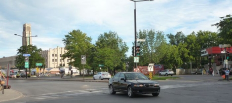
Starting here, 6th and Wellington in Verdun.

Headed west on Wellington. This is the very popular Turkish restaurant, Su.

And on the corner of Desmarchais and Wellington, Le Tire Bouchon.

Desmarchais is one of two streets in Verdun that has a median (we will see the other one later).

This location on the north west corner was Wolfe Cycle for decades. But they closed and, much like up on Verdun avenue west of Woodland, they have adapted former commercial spaces into residential spaces. Not sure that is so good long term, but they can be rehabbed I guess.

Heading north on Desmarchais. The median. Only “side” that has shade most of the way.

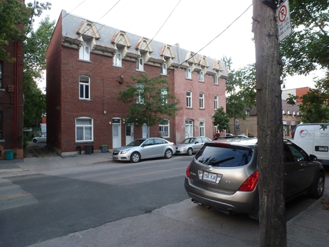
Typical duplex style housing along here.

But most of it is attached.

At the corner of Verdun we see Verdun Elementary School. Believe it was called Woodland School (probably a Facebook group about that) back in the day but having been reared through the Catholic system I can’t confirm that.

Former site of Cafe Kali where we were holding The Jam last winter. Sad to see it closed. I had thought we had a really good thing going, c’est la vie, who knows, we may get there again!

Half way down this block is the entrance to what used to be Verdun’s Anglo pool hall. It’s like a dream now, snooker, drugs, outrageous characters, and a couple of great players, powerful memories for hundreds, if not more than a few thousand, of people for sure…

An example on the north side of Verdun Avenue between Melrose and Argyle of former commercial spaces being converted to residential.

And some will remember when this was Leonard’s, a complete “little guy” grocery store, the type of which were the norm before the big boxes steamrolled all the little guys out of business.

Between Argyle and Woodland this is a popular bakery, good bagels and coffee!

Turning north on Woodland, Verdun United Church.

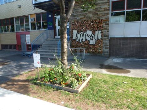
And just past that, Dawson Community Centre, one of the oldest and most loved and fondly remembered community centres in Verdun.

It’s a great community centre. The little garden around the tree is a reference to their rooftop garden program and the mural was made during their street festival/Race for Kids event earlier this summer. Awesome!
Typical look along Woodland.

But there are these nice small houses as well.

Eglise Baptiste Evengelique de la Grace on the southwest corner of Bannantyne and Woodland.

Moving west on Bannantyne I see this very serious refuse chute.


And just west of the church was a recreational hall referred to by my generation as “The Rec” or maybe we meant “The Wreck?” In any case there were dances there and hundreds of teenagers with hormones exploding all over the joint would come here for dances. It was the late 60’s. I won’t say much more. The original building is long gone and it looks like this today.

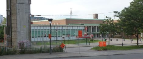
The Verdun Cultural Centre/Library.

And inside there is an exhibition by Santerre.

It’s an excellent show with a lot of Pop Art stuff going on. Check it out!

Heading north on Brown.

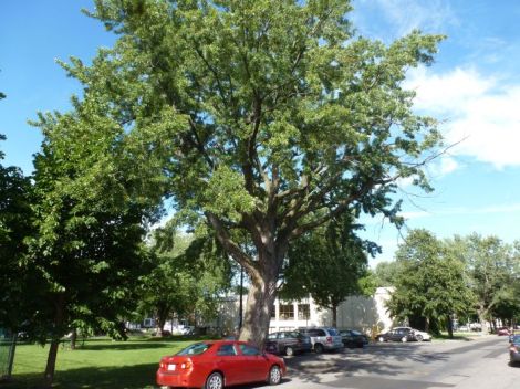
Old tree.

The west end of Verdun is dominated by duplexes compared to the rest of the city where the dominant form is the triplex.

As you approach Beurling, Brown narrows back into a regular street but one still divided by a median, like I mentioned about Desmarchais earlier.

Park north of Beurling I often hung out in during my high school years.

Cottages along here of the style common in Crawford Park.

Heading west on the Aqueduc. This is Beurling Academy, known as Verdun Catholic High School back in the day. I have some fond memories of that time but also some nightmares I would prefer to forget. I am sort of indifferent to the place today, say, compared to most students who may have had a wonderful experience.

I have no idea why there is no pedestrian path along here when they have plenty of room?

Heading across the bridge at Stephens looking west.
Social housing along La Verendrye in Ville Emard.

Heading up Monk Boulevard. Lots of small houses like this around here and in Cote Saint Paul.

Decided to take the lane between Raudot and Allard. Not sure if lanes really tell you a lot more about a neighborhood, but they can be interesting.


Came back out in front of the Monk Metro station.


If you need to find your local MP.

Parc Garneau in the tradition of the city square.

Cenotaph.

Green Stop Restaurant on the corner of Jolicoeur and Monk (not to be confused with the Green Spot in Saint Henri).

Fire station and Maison de la Culture Marie Uguay under one roof.

Zoomed a bit, this street points towards the “Superhospital” in NDG.

Notre Dame du Perpetuel Secour.

Interesting use of the street on de Biencourt.

I saw a couple of people take some clippings so these are real gardens.

One lane is kept open to traffic.

Obligatory piano.

Where the twain shall meet? Condos on one corner and social housing on the other.


One last look.

More social housing.

Little green space near Denonville.

Monk street bridge. I am going to go right along Saint Patrick.

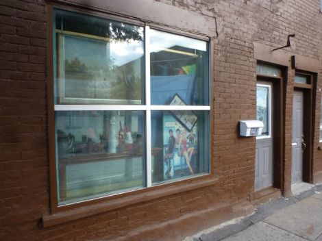
As you see above there are these photographs by Jon Rafman who is best known for using images taken in Google Street View.

Former factory on Saint Patrick is now full of small to medium sized businesses.

Moving east along the Lachine Canal, kayak rentals.

Coming up to Turcot, the old de l’Eglise bridge which was the only way for traffic to cross the canal around here before the Monk street bridge was built about 15 years ago.

Looking west.

Looking east.

Just west of the bridge is Muzo, pet resort.

Turcot.


And they will keep painting it over.

Gadbois, Turcot, Superhospital.

Bus shelter in front of Gadbois powers itself.

Young person had an accident here but she will be fine.

How things change…I started cycling the Canal in the early 80’s when it was opened up to the public and there was still some small factories along here.

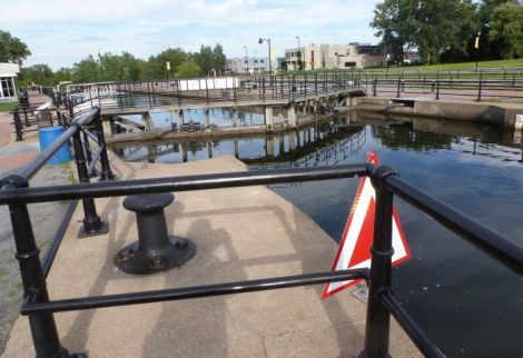
Lock filled up.

McAuslan Brewery terrace, hipster heaven.


Have explored there many times, good to see people still interested.

Creative little space by the fence.

East side.

Crossing over the Saint Remi Tunnel and a pic I took in the 80’s when it was flooded.

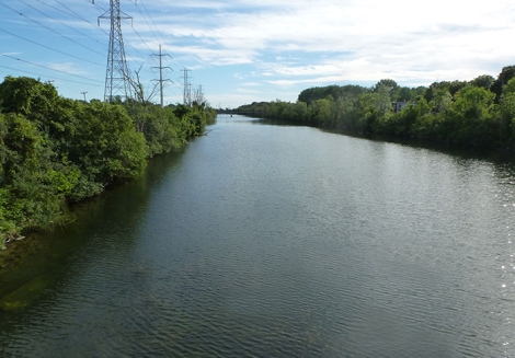
This might be the widest section of the canal.

Came across this strange little improvised area along a chunk of bike path that may have never been active.


Little Boat with Water Tower.

Going to run out of path after that bridge so I decide to cut up into Saint Henri here.

Centre Recreatif, Culturel et Sportif St. Zotique. Many of the Turcot public consultations were held here and I met some amazing people along the way.

And across the street is Parc Sir Georges Etienne Cartier, another of the great city squares/parks in Montreal.

Typical housing around the park.

Beautiful fountain.

Film shoot.

Heading east on Notre Dame, Eglise Saint Zotique with top of steeple missing I first mentioned in Walk #7 and weird bank building (white painted concrete slabs laid atop one another).

Notre Dame through Saint Henri is a work in progress. A friend, who also ran for office in 2009, and I counted all the closed commercial spaces between here and Atwater in 2009 and there was close to 25! Only a handful now, tops!

There are times when I wish I was less observant.
Overpass coming up.

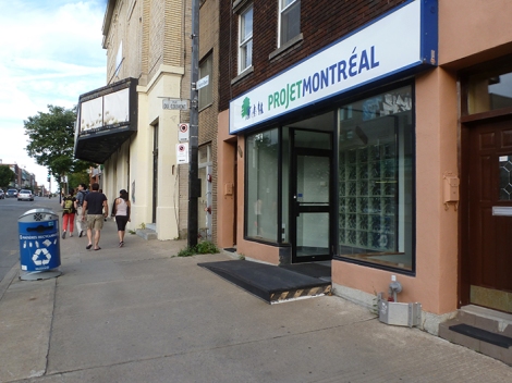
Projet Montreal headquarters. Former Vendome and then Dome Theatre of Dawson College just ahead.
Former rail right of way and, much needed for the area, supermarket.

Aliens are taking over.

Shabby looking stretch.

I love this little spot that commemorates Gabrielle Roy‘s novel Bonheur d’ocassion (The Tin Flute en Anglais) and if you throw in a piano for the summer – Awesome!

Legendary. New System BBQ has like 3700 delivery cars – moving to Toronto? No problem! (wink).

And here is the Green Spot (not to be confused with the Green Stop in Ville Emard {scroll back if you must lol}).

Notre Dame and Atwater. Atwater Market in the background.
Better view of the market. There is an entire floor missing from the original building after a fire in 2002.

There has been a condo explosion along the canal over the last 30 years.

The Market area is pretty cool down by the canal. These exhibitions run all year round.

I don’t know if there is dancing every night but people seem to be having fun.

Finally read the menu for this boat that never seems to go anywhere- it’s a bar.

Crossing the foot bridge over to Point Saint Charles.

Looking east at the Charlevoix bridge.

Looking back from the south side of the canal.

Can’t recall the names but someone told me that this park is being built to commemorate some local women.

Yep, some people live this close to the Lachine Canal bike path.

Rest area?

On standby.

Closer look at the Charlevoix bridge.

Don’t take this path.

Legendary tavern closed last year.

Walking along Charlevoix in the Point.

Odd shaped building.

Classic.
Regal brasserie on the corner of Centre.

And the Charlevoix Metro is calling my name.

And another exploration of this awesome city comes to an end. Take care and keep moving, says the ‘ol photoflanneur!


don”t care much for Monk metro station. They had to raze the home of the original D’ilalo burger.The burgers have never been quite the same..