
“This is what I had come for, just this, and nothing more. A fling of leafy motion on the cliffs, the assault of real things, living and still, with shapes and powers under the sky- this is my city, my culture, and all the world I need.”
― Annie Dillard, Pilgrim at Tinker Creek
I did not plan to walk in a large circle when I started out but at some point it became a solid idea when looking at maps, so it was exciting to close the loop today!
As usual, started off where the last one ended at Vendome Metro.

I have no idea why they decided to put a standard sized bus shelter there. The 105 bus comes often and there is usually something of a lineup at any time of day. A sixty footer would be much more appropriate. Seems like an unnecessary or inadequate good intention.

Busy little scene as I take one last look back.

Heading south on Decarie. Good view of the Superhospital also known as the McGill University Health Centre (MUHC). McGill campus downtown was/is surrounded by hospitals so I am still wondering why this was such a great idea (I mean moving them here instead of just building here as an extension of the other operations).

Crossed over on to Crowley. Here is the Crowley Arts Centre where in February there was a benefit concert for fire victims in Verdun who had lost their homes on Christmas day.

Turning south on Prud’homme it almost looks like a nice park but the Decarie Expressway is just there.

Looking down what seems like an unusual through lane in the middle of a block.

And looking out at the point where Decarie runs into Turcot.

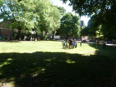
On the far side a group of people walking along looking like they are inspecting things.

No access to Saint Jacques at this point.

So I cut through the Mazda dealer parking lot and came out here.

There is a bike path and a sidewalk that goes all the way down to Saint Henri. I took the sidewalk even though the near empty bike path seemed the less stressful route for those who don’t like traffic. I was thinking picture taking.

The hospital has this surreal or not quite real look to it from some angles.

The not so exciting view south.

This must be the Children’s Hospital part of the complex. That statue looks like it may be inside and outside of the building.

But it is not.

Everything also seems to be properly corporate branded around here.

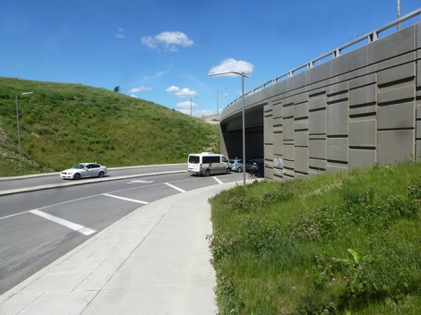
Part of the old Turcot coming in to view.

It’s a long stretch down.

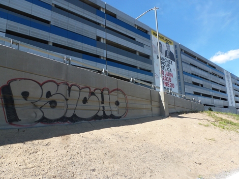
This wall has been written on but no major pieces yet I guess.

It’s just one massive construction site on the other side.

Huge poster on the side of what looks like a parking lot is a year old. Budget? (Yes, that is Mayor Coderre with someone from the hospital).
Leaving Turcot.

Towards the bottom. Don’t know about lighting but this could be a very creepy walk at night.
The bottom.

Looking east.

Decided to cross here and head into Village des Tanneries. Parts of the original village have been discovered in recent years only to be deemed unimportant in the mind of the Ministry of Transportation and the Ville de Montreal.

Neat little plant protectors on Desnoyers.

Community street sign with names only locals would know, sorry, google!

The north side of Cazelais (right side in picture) was saved due to public pressure but they will have a freeway in their back yards. No such luck for 780 Saint Remi which would have been visible at the end of this street.

Taking a tour through the green lane behind Desnoyers. Good story on this project here.

Resources, ideas, and information being shared.

The lane is quite a contrast between new condos and old triplexes facing each other. Hopefully it is working out well for all.

Throw in some old factory architecture…

Cut through the end of the condos.

Square Sainte Elisabeth.
Side of a school building on rue Delinelle.

Lots of trenches and other stuff being dug, detouring is the (not so) new normal in Montreal.

Looking across at Eglise Saint Zotique. I could swear the steeple on the left was intact just a few years ago (and it was just last year, see this article).

Moving on besides the tracks, on my left is Parc Emile Berliner, named after the man who invented the phonograph record and the gramophone, and there is a strong local connection as this wiki page attests.
“Berliner Gram-o-phone’s facilities in Montreal, a complex of buildings at 1001 rue Lenoir and 1050 rue LaCasse in the St-Henri district, became home to RCA Victor Canada over the next several decades,[12] developing and producing such high-tech products as microwave radio relay systems, communication satellites, television broadcast equipment, etc. Since the dissolution of RCA in 1986, the Lenoir building has been turned into a multi-use office/commercial building, but the Lacasse facility is now The Emile Berliner Museum,[13] documenting the history of the man, his company and the building complex. The historic Studio Victor located there is still an active recording studio.[14]”

Not sure how this happened (but I do suspect some creative types enjoyed themselves) because that fence is quite recent compared to the tree.

Siding sign lets trains know where they are. Seems to me these are usually located one mile from the actual siding/town but I could be wrong.

A message from the side of the tracks.

Closer up.

And I come out near the viaduct on Sainte Marguerite.

And up the other side and on to rue Charlebois.

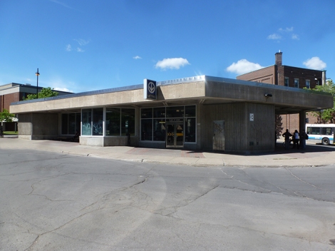
Place Saint Henri Metro Station.
Across Saint Jacques.

Two old buildings setting the architectural pace in Place Saint Henri.

This old fire station is probably Saint Henri’s most iconic building. And I am thinking of a quote usually attributed to Mark Twain – you can’t throw a brick in Montreal without hitting a church window – and wondering if we shouldn’t just switch “church window” for “detour sign?”

Heading east on rue Notre Dame is Projet Montreal headquarters besides what used to be Dawson College’s Dome Theatre, which was formerly the Vendome Cinema.

Cut down on Workman street.

And head east along Parc du Premier Chemin de Fer. It’s basically a thin green belt with a pedestrian/bike path that flows along an old railroad right of way between Place Saint Henri and Lionel Groulx Metro.

And some housing projects filled in the rest of the once open space.

The sculptor, Jean Brillant, has many works along here.

I am very biased in my appreciation of sculpted art that pays homage to Montreal’s outdoor staircases, both front and back. And you will meet very few people who support public art more than I do…
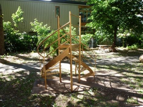
…so, of course, I cringe a little when I notice how these works remind me of the now infamous (and horribly embarrassing) granite stumps proposed for Mount Royal! And do please consider signing the petition!
At the end of the trail, entrance to Lionel Groulx across the street.

Looking south down Greene Avenue we can see the tower of the Atwater Market.

At the end of that particular trail at Lionel Groulx Metro.

Waiting to cross Atwater. I can remember when this was a busy commercial street and you had to wait for trains, so on a trip from Verdun to downtown, you might have to wait 5 to 10 minutes for a train to cross Atwater. It was normal at the time and being a kid I loved seeing what type of train would roll through – good times. It was probably around the mid 60’s when all this type of stuff started to disappear. Expo 67 was an awesome event that everyone remembers very fondly, yet it also signaled the end of an era when the city was vibrant and exciting and something was happening everywhere and it was all very colourful, but the automobile took over and bare concrete high rises were being built, as if the gray heavy bulk of concrete was beautiful, and that was not necessarily a good thing in my opinion. Took a long time for some parts of the city to breathe again.

Looking south on Atwater.

Heading east on avenue Lionel Groulx and into Little Burgundy.

Not sure what this main floor space is, but you can bet it was a typical Montreal neighborhood tavern at one time. Corner of Lionel Groulx and Vinet.

In the southeast corner of Parc Vinet is the Centre Culturel Georges Vanier.

Northeast corner of the park is the CEDA building.

Bet there have been some memorable games here.

I can’t tell the difference anymore if this is some beautifully preserved chalet or just some relatively new building designed to look historical.

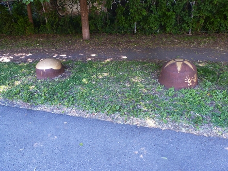
Adding in this word sculpture because any place that has a library component has got to be worth a second look!

Moving east on Workman.

More housing probably on old rail lines.

Centre Sainte Cunegonde, an eco quartier.

Small houses but probably owned by people who would neither have bought a big house or chose to have lived in suburbia.

Cutting through Parc de L’Association Eureka.

Some nice paths cut through this neighborhood.

Parc Herb Trawick, named after the first African American to play Canadian football.

Corner of Richmond and Lionel Groulx and the proximity to downtown.

Le Salon 1861 on Richmond street.

Parc Guy Paxton, just east of rue Guy.

More recent housing along Victor Hugo. This is part of the infill after the tracks that ran between Notre Dame and Saint Antoine and Guy and Peel were torn up in the late 80’s. Tons and tons of potential here, including that elusive downtown ball park, that were passed over for this.

And on to Notre Dame street.

This stretch always did serve as the commercial artery for Griffintown.

Approaching Peel street it’s all big buildings along here.

Caisse Desjardins du Sud Ouest – Centre de services Griffintown.

And what’s left of the old Dow Brewery, an urban explorer’s paradise.

Looking downtown.

Ecole de technologie superieure, also once a Dow Brewery building. And the concept of using real police officers to direct traffic is losing it’s appeal.

Shot from the hip, so to speak, while being rushed through by a traffic cop, didn’t turn out too badly.
Former Dow offices.

The Rodier building, still standing, despite rumors of demoltion-for-expressway.

The Farine Five Roses sign barely visible in the distance.

Closer look.

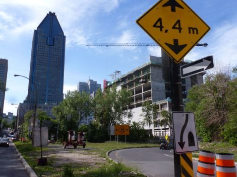
View up Robert Bourassa blvd, formerly known as University.

Tail end of a passenger train going up to Central Station.

We got stuck waiting here for about ten minutes. There simply has to be a better way to do this and keep things moving in all directions. People on foot need to be somewhere too.

Traffic backing up behind us.

And they finally let us through to navigate this block.

Square Victoria tower.

This is a mediocre picture but I do like that the trash chute and the cafe umbrellas almost match and the out of focus Detour sign pointing into a building pretty much says it all for this town this summer!

Old Montreal coming up.

I used to buy film and paper and chemistry here back in the day but am now a very happy digital age camper!

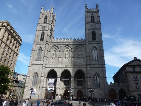
Tourists lined up for Notre Dame.


People resting at Place d’Armes.

And this is what all the fuss is about.
Your inevitable souvenir shops.

Cut through a parking lot to get a shot of the La Presse building and the Palais de Justice.
Buildings in Montreal are almost paraphrasing Oscar Wilde – The only thing worse than being worked on is not being worked on. Original quote here.

Sculpture in Place Margaret Bourgeoys.

The old Palais de Justice, now a city administrative building.

Even the Nelson Column at Jacques Cartier Square is undergoing surgery. Heck, I have seen so many wrapped towers/columns/assorted structures lately its enough to make me think Christo is in town.


It’s all nice to let everyone know what you are up to and be proud of past accomplishments but is the city really sure it wants to make that strong a connection between the 76 Olympics and the upcoming 375th Anniversary of Montreal in 2017?

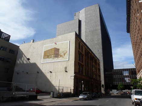
Turning down Gosford, the old municipal courthouse with the new CHUM hospital in the background (a sure sign our circle is almost complete).

The usual tunnel to the Metro is, yep, closed for repairs, so I had to detour, naturally, and I might be getting to like detouring in a weird sort of held hostage way ( lol ), along Saint Antoine. This is the bottom of the actual Champ de Mars.

North on Hotel de Ville.

And east on Viger.

Just sailing in to Champ des Mars Metro now.

And one final look.

Wow, this was sure an interesting leg. But completing the circle is the big story here. Feels good, was a lot of fun, and hopefully you have enjoyed coming along on the virtual tour. Not sure what the next walk will be but I will probably use this circle as a jumping off point for other walks around this fascinating city. Take care, but get out there, says the old photoflanneur!
Map of today’s walk.

And here is the “circle” completed with today’s walk.


Pingback: Walk # 8 | PostArctica·
Pingback: Walk # 11 | PostArctica·